 MENU
MENUWalking and Hiking Routes
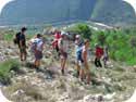
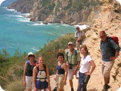
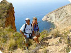
The following walking and hiking routes are located in the Alicante and Valencia regions but represent only a small proportion of routes that have been used by our mountain club.
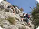
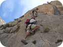
Some of these routes involve an easy grade 1 scramble with no exposure and others offer a higher grade scramble option. Easy routes begin from the top of the page. From beautiful coastal and inland walks to more strenuous mountain hikes, these routes can be enjoyed by everyone. See Photo Gallery.
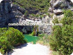
Cala Blanca to Playa La Barraca
 Starting from Cala Blanca in Xábia we follow a path from the beach to the cliff top. A short walk on the CV742 Xábia to Cap de la Nao road brings us to the Creu del Portitxol and a track leading down to Cala Sardinera. Follow the contour of the headland to Cap Marti. An optional scramble takes us to the end of the headland at Cap Prim. Continuing our contour walk we pass Playa del Portixol with beautiful views of the Isla del Portitxol. A rough track leads to Playa la Barraca where we lunch in a small beach restaurant. Our return to Cala Blanca is via alternative paths. Duration includes lunch. Easy hike.
Distance 8km. Duration 3.5hrs. Ascent 366m.
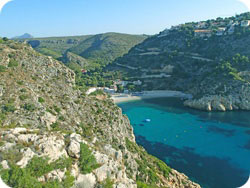
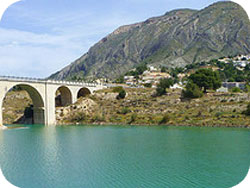
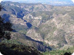
Traversing the Guadalest Embalse.
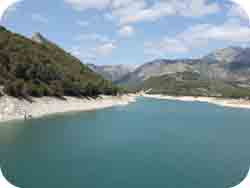 A pleasant walk in any type of weather.
Our route starts from the dam in an anti clockwise direction followed by a stroll and drink in the little village of Beniardá. We then descend from the village and follow the south track back to the dam.
12km. Duration 3.45hrs. Ascent 227m.
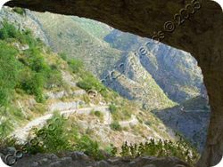
Plana de San Jerónimo to Denia. Height 164m
 Starting from the Xábia marina this cliff top walk follows a path up to the Cabo de San Antonio lighthouse. A track then leads to the historic sea cave Cova Tallada and the Torre del Gerro. Following a cliff track you arrive at Les Rotes where a sea front path passes numerous restaurants and eventually the Marina de Dénia where we lunch. A car shuttle is necessary. Moderate hike.
Distance 14km. Duration 4.5hrs. Ascent 450m.
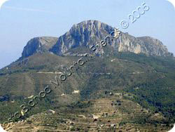
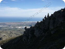
Serra del Montgó Sunset Hike.
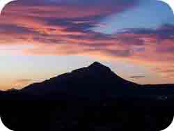 One of the most spectacular scenes in the south of Xábia is when the sun sets to the west of the Montgó. From the Montgó 696 metre Creu de Denía there are more beautiful vistas as the outlines of Serra de Mondúver, Serra de la Murta and other westerly peaks are silhouetted by the sun.
During June or July with near perfect weather we commence our evening hike to the Creu de Denía where the iron cross is located. Our start time is usually 19:30 hrs allowing enough time for a sunset at about 21:30 hrs. Descent in the dark is aided by head torches. Grade 1 scramble.
Daytime. Distance 10.5km. Duration 3.5hrs. Ascent 590m.
Ascent in light. Moderate hike. Grade 1 scramble. 1.5hrs.
Descent in dark. Difficult hike. Difficult scramble. 2hrs.
Cala de Llebeig
 One of our best coastal routes and ideal for the summer. After an optional scramble down the Barranc dels Testos we commence our walk from the beautiful water caves at Cala Moraig.
Route 1. To the isolated and beautiful Cala Llebeig “Smugglers Cove”. Return to Cala Moraig by the same path.
Easy hike.
Distance 8km. Duration 4hrs. Ascent 586m.
Park » 38.711274, 0.165193
Route 2. Exit via Barranc de la Cala and Viuda. Easy hike.
Car shuttle.
Distance 6km. Duration 3.5hrs. Ascent 250m.
Route 3. Continue from Cala Llebeig along the coast until Punta de Moraira. Then descend to El Portet. Car shuttle. Grade 1 scramble. Distance 10km. Duration 5.5hrs. Ascent 670m. Moderate hike.
Route created by Vic Warth June 2006.
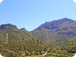
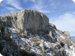
Serra dels Castellets East Circuit. Height 806 metres
 Starting from the small El Realet urbanization below the south face of the Castellets, follow the road passing Finca Cajubama and continue to the top. A steep and narrow agriculture track leads to the Portell de López. Easy tracks heading north east below the north buttress will eventually arrive at the Collado de Sacarest.
Moderate but steep hike.
Park 38.603477, -0.211710
Distance 11.5km. Duration 4.5hrs. Ascent 575m.
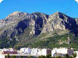
Serra Gelada. Height 435 metres
 Fantastic views can be seen on the summit of Gelada from isolated coves to the awesome tower blocks of Benidorm. Our hike starts from the Albir beach top car park with stops at the ancient ochre mine and lighthouse. The route to the summit can be via an optional scramble or by track. From the repeater masts the cliff top track leads us to above Mundamar. With the right timing you might see a show for free! Route 1. Albir to Benidorm with car shuttle. Moderate hike. Optional grade 1 scramble. Distance 7km. Duration 4.5hrs.
Route 2. Albir to Benidorm and hike back via similar route. Strenuous hike. Optional grade 1 scramble. Distance 14km. Duration 6.5hrs. Ascent 675m.
Cala Granadella from Xábia.
 A circular route starting from the Xábia El Tosalet entrance to the Parque forestal de la Granadella and following the PR-CV-354 west towards Cumbre del Sol. Just before Cumbre del Sol turn south and cross the Barranc de Martorell. Then head east towards Granadella still on the PR-CV-354. After about 1km there is a signpost indicating a right turn to the castell or left to Cala Granadella via Variante Gurugú. If the weather is bad then go direct to Cala Granadella via the Gurugú route. The route to the castell is safe and beautiful in good weather and is supported by a handrail and chain but the rocks are slippery when wet. When departing Cala Granadella the PR-CV-354 track is partially hidden but starts to the left of the main road CV-7420. Then follow the green and yellow stripes back to El Tosalet.
Park. 31 S 0255808 4292604.
A circular route starting from the Xábia El Tosalet entrance to the Parque forestal de la Granadella and following the PR-CV-354 west towards Cumbre del Sol. Just before Cumbre del Sol turn south and cross the Barranc de Martorell. Then head east towards Granadella still on the PR-CV-354. After about 1km there is a signpost indicating a right turn to the castell or left to Cala Granadella via Variante Gurugú. If the weather is bad then go direct to Cala Granadella via the Gurugú route. The route to the castell is safe and beautiful in good weather and is supported by a handrail and chain but the rocks are slippery when wet. When departing Cala Granadella the PR-CV-354 track is partially hidden but starts to the left of the main road CV-7420. Then follow the green and yellow stripes back to El Tosalet.
Park. 31 S 0255808 4292604.
Route 1. Moderate hike. Distance 12.5km. Duration 4hrs. Ascent 465m.
Route 2. Easy hike. Distance 11.5km. Duration 3hrs. Ascent 367m. Via Variante Gurugú and avoids ascending to the castell in bad weather. Or continue on towards the castell and then descend to Cala Grandella via Variante Teulería and the Casa del Frances ruins.
Route 3. A more adventurous ascent or descent is the Cresta Cuatro that is located between Variante Gurugú and Variante Teulería.
Serra d’Oltá. Height 587m
 From the N332 at Calpe follow the signs to the Estación de Ferrocarril and then cross the railway lines. Follow the winding road up the hill and park at the campsite. There are several well marked routes to the summit with an optional scramble. Good all round views including the Penyal d’Ifac. Easy hike.
Distance 8km. Duration 4hrs. Ascent 430m.
Barranc del Cau.
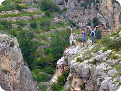 This circular route starts from Jalón and enters the Cau from the north. A good parking area can be found at the following map coordinates 30S 0760408 4291097. Our ascent is normally from the west bank of the barranc and by following the Mozarabic trails we reach the Alt del l’Ample at 603m. 30S 0759745 4290072. During the ascent one can view the amazing network of bancales and mozarabic trails on both sides of the barranc. From the Ample we continue south and follow a marked trail which eventually heads north and returns via the east bank of the barranc. Easy hike.
Distance 10km. Duration 4.5hrs. Ascent 430m.
El Barranc de l’Encantada
 A beautiful inland hike with plenty of running water. The circular route starts near Planes and passes through El Barranc de la Encantada which flows into the río Serpis. Easy hike and swim.
Distance 12km. Duration 4.5hrs. Ascent 529m.
El Castell de Gallinera y Benirrama. El Miserat. Height 756m
 A circular route starting from the village of Benirrama in the beautiful Vall de Gallinera. The initial ascent is through the cherry orchards. A small track eventually leads to the base of the Miserat. Once on the Miserat summit we descend to the Castell of Gallinera and Benirrama and then return to the Benirrama village car park. Moderate hike.
Distance 10km. Duration 4hrs. Ascent 595m.
L’Alt de Les Creus. Height 540m
 Our hike starts from the historic village of Tabernes de la Valldigna which is one of four villages that constitute the Valldigna and surrounded by the Serra de Corbera and Serra de Mondúver. From the village you can view the famous large crosses on the three peaks. Following the route PR-38 we ascend in an anticlockwise direction passing the first cross. After the summit we head for the Barranc de la Penya Roja. Descent from here takes us past the via ferrata and then back to the village. Park 30S 0736838 4329103 Moderate hike. Distance 12km. Duration 5hrs. Ascent 630m.
Pla de la Casa. Height 1385m
 We start our hike from the village of Facheca on the CV-720. Follow the PR-CV182 track through the Barranc del Moro passing the Font de Barranc. Then on to the summit and the nevera. Continue west on the same track to the Font del Cirer. Now head north staying on the PR-CV182 passing the Pou Romo and return to Facheca. Splendid views all round. Moderate hike.
Distance 9.5km. Duration 4.5hrs. Ascent 770m.
Serra d’Orxeta and Embalse.
 A beautiful and varied route encompassing the embalse, the 600 metre high Serra d'Orxeta and the picturesque village of Orxeta. Ascent is via the PR-CV353 with superb views from the summit including the Aitana, Castellets and Puig Campana.
Moderate hike. Distance 12km. Duration 5.5hrs. Ascent 585m.
Car shuttle short route 9km. Duration 4.5hrs. Ascent 554m.
Serra de la Foradá. Height 854m
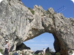 Commencing from the village of Benissivá on the CV700 Vall de Gallinera road follow a camino that passes El Convento de los Padres Franciscanos. An ancient track leads to the summit where a short walk to the east brings us to an Iberian cave dwelling. Heading west we soon arrive at the conspicuous La Foradada or rock arch where a solar alignment occurs twice a year. When the sun's rays pass through the arch they strike the exact spot where the old Franciscan convent of Benitaia stands. Continuing west we then descend to the Castillo de Benissili where the hike ends. La Vall de Gallinera is a major cherry cultivation area. Car shuttle required. Optional grade 2 scramble over arch. Moderate hike.
Distance 13km. Duration 5.5hrs. Ascent 845m.
El Somo Circuit.
 A circular route around the plain looking 882 metre El Somo. At Km-7 on the CV-752 the marked track leads to Corral del Somo and Aljub del Xarquet with views of Els Arcs. The 739 metre Penya del Castellet also known as Bolulla Castle can be seen from the south side of El Somo. An optional ridge scramble or track leads to the castellet summit. The hike is resumed by returning to the main track and heading in a north easterly direction. Eventually the track runs parallel with the CV-752 in a westerly direction. Before Km-6 a track leads to the El Somo summit and Cova del Somo and then back to the car park. A beautiful route with good views. Moderate hike. Optional grade 3 ridge scramble.
Distance 13km. Duration 5.5hrs. Ascent 634m. Note: Add 1 hour to the duration when visiting Els Arcs.
A circular route around the plain looking 882 metre El Somo. At Km-7 on the CV-752 the marked track leads to Corral del Somo and Aljub del Xarquet with views of Els Arcs. The 739 metre Penya del Castellet also known as Bolulla Castle can be seen from the south side of El Somo. An optional ridge scramble or track leads to the castellet summit. The hike is resumed by returning to the main track and heading in a north easterly direction. Eventually the track runs parallel with the CV-752 in a westerly direction. Before Km-6 a track leads to the El Somo summit and Cova del Somo and then back to the car park. A beautiful route with good views. Moderate hike. Optional grade 3 ridge scramble.
Distance 13km. Duration 5.5hrs. Ascent 634m. Note: Add 1 hour to the duration when visiting Els Arcs.
Serra de Cabezón del Oro. Height 1208 metres
 From the village of Busot follow signs to Cuevas de Canalobre and then park near the PRV-2. The popular route to the summit is indicated by white and yellow markers. An optional scrambling section is available. The descent is made by following the markers in a clock wise direction which sweeps round to the Cuevas de Canalobre and then the car park. Moderate hike.
Distance 13km. Duration 5hrs. Ascent 970m
La Vall de Laguar.
 From the tiny village of Fleix we descend to the valley through the small rock forat and pass a waterfall that is normally dry. The Mozarabic steps lead to the normally dry bed of the Riu Ebo where we cross and ascend. The route follows west and again descends to the Ebo north west of the Barranco del Infierno. A further ascent finally leads to Benimaurall and Fleix. A beautiful route with spectacular views. Almonds, cherries, oranges and figs can be seen growing. Two old Lavaderos are passed on this route. Strenuous hike. Park 30S 0751152 4296360 Start 30S 0750866 4296174. Distance 15km. Duration 5.5hrs. Ascent 887m.
Serra de Mondúver. Height 847m
 Apart from being the highest mountain in the Gandia region the Mondúver offers spectacular views all round. Starting from Xeresa we follow one of the many marked routes on the PRV-153. After passing Font de Mondúver the ascent becomes steep all the way to the summit marked by the TV repeater aerials. Our descent is northwards enabling us to take a figure of eight route which finally ends through the quarry. Strenuous hike. Route 1. Distance 16km. Duration 6hrs. Ascent 1015m.
Route 2. Distance 13km. Duration 5hrs. Ascent 723m
El Barranc de Malafi and Serra de Alfaro.
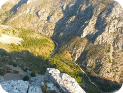 A spectacular circular route which includes ascent of the 1165 metre high Alfaro and descent through the wild and forbidding but beautiful and green Barranc de Malafi and woodlands. Our route starts just past Pla de Petracos at the crossing of the Malafi. After a gradual climb the track levels out as the Punta de Alfaro is approached. Continue south west with views of the Malafi as the summit of Alfaro starts to appear.
From the summit of Alfaro descend north on a zig zag track towards the Barranco de Malifi with views of Tollos village to the north west. At the end of the track on a rough road turn right in a westerly direction passing a small quarry on the right. Continue into the Malafi with views of the Raco de Espinal arêtes on the left followed by a ruin. Towards the end of the barranc hike there is a weir which is about 10 minutes from the car park. Strenuous hike.
Park 30S 0743797 4295174. Distance 16km. Duration 5.5hrs. Ascent 755m.
Pas dels Comptador to Refugi Font de L’Arc circuit
 Starting from half way up the PR-CV9 Pas dels Comptador track we proceed through the old goat counting pass. Our descent towards Sella is via the PR-CV9 passing Cases de L’Arc. At Refugi Font de L’Arc we follow the PR-CV12 until the Mas de Sanxet de Baix. At this point we veer off left and up through the spectacular Passet del Golero. From the Passet we follow a rough track north east which eventually rejoins up with the PR-CV9 and Pas dels Comptador. Strenuous hike. Distance 17km. Duration 7hrs. Ascent 787m.
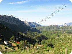
Montcabrer. Height 1390m
 The Serra de Mariola mountain range is located in the Parc Natural and the highest peak is Montcabrer. The Parc is located between Cocentaina, Alcoi and Bocairent and covers an area of 16,000 hectares with numerous hiking routes and beautiful views.
Our hike starts from the car park at Sant Cristófor. On route to the summit we pass Fonts de Huit Piletes, L’Esquererola and de Sanxo. Then the ruins at Mas de Llopis. After a steep climb we reach the Montcabrer summit. Our return route is via the Barranc del Carrascalet passing Fonts del Carrascalet, de Julia and dels Bassiets on the PR-V37. Finally we ascend to El Castell before descending to Sant Cristófer and the car park. Strenuous hike. Distance 18.5 km. Duration 7 hrs. Ascent 1207m.
Malla del Llop. Height 1360m
 Malla can be accessed from Famorca but we prefer to park at Guadalest to start our route to the summit from Serrella Castle. From the castle we ascend the large Barranca de Canal with it’s twin fins. Descent is to the north passing numerous water casitas with views overlooking Famorca and Castell de Castells to the north east. The return route is eastwards along easy tracks. An interesting circuit with stunning views overlooking the Guadalest valley and reservoir. Strenuous hike.
Distance 15km. Duration 6hrs. Ascent 992m.
Rio Serpis from Lorcha
 A beautiful route along the banks of the Rio Serpis. Our hike starts from the old disused railway station and hotel in L’Orxa/Lorcha. Following the banks of the Serpis we pass through a series of railway tunnels, a weir and two Hydro electric stations. At the last station we leave the Serpis and ascend the 1012 metre Azafor. Our return route is via a marked rough trail leading to the east of L’Orxa/Lorcha. Strenuous hike. Distance 20km. Duration 6.5hrs. Ascent 1040m.
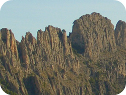
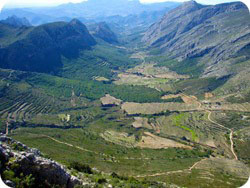
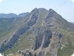
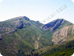
Serra d’Aitana. Height 1558 metres
 As the highest mountain in the Costa Blanca Las Marinas area the Aitana is 214m higher than Ben Nevis and 473m higher than Snowdon. From the CV70 and Benifato a winding track leads to the car park at Font de Partagás. From there a track ascents the main crag to the summit via an easy scramble through the Passet de la Rabosa crack. Once on the summit we continue east for several kilometres and then descend near Penyo Mulero. Our return route to the west and Font de Partagás is along a wide track. Moderate hike with grade 1 crack scramble.
Distance 13km. Duration 4.5hrs. Ascent 662m.
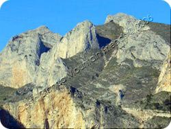
Serra del Bérnia. Height 1125m
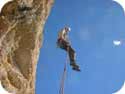
 Forat and Fort. A beautiful looking mountain offering hikes, scrambles, abseils and rock climbing. The forat (hole) joining the north and south faces is approximately 1 metre high by 25 metres long and with mist on the north face and sun on the south it’s like stepping into another world. The views from either side of the forat are beautiful. Goats herds frequent the Bérnia and to the south west there are ruins of an old fort. On the north Approach path there is a font where you can refill your bottles. All our routes start from the restaurante Bérnia car park area.
From the car park follow the track heading east towards the font. Continue on the track above the steps of the font until the forat is reached. Crawl through the forat and then follow the track heading west. Then descend this track to the fort. From the fort follow the orbital track heading clockwise back to the car park. Moderate hike.
Distance 10km. Duration 4hrs. Ascent 495m.
Almadich Circuit.
 The hike traverses the famous Almadich geologic formation where evidence of the Earth’s early sedentary processes can be seen. Starting east of Benichembla on the CV-720 we gain height above the Barranc d’Almadic and head south west. The track follows the upper contours of the Almadich with the Cordilleras Summit higher up to the south and Benichembla and Serra del Penyó to the north. Approximately 2km from the Cocoll Summit we head north east and exit west of El Mirabó. Moderate to strenuous hike.
Distance 14km. Duration 6hrs. Ascent 830m.
Penyes Blanques Circuit.
 A grand tour starting from Pedreguer village. This scenic route includes Font de Aixa, Penyes Blanques 475m, Tossal Gran 591m, Castell de Aixa 607m and Castellet de la Ocaive 300m. The tracks are good and pass by numerous ruins, bancales and wooded areas. There are several very easy scrambles. Beautiful views can be seen of Jalón, Lliber and Llosa de Camacho. Safe parking in the village can be found at GPS grid 31S 0242448 4297928. Strenuous hike.
Distance 16km. Duration 6.5hrs. Ascent 1045m.
Sanchet Circuit.
 Located near Polop off the CV70. The route starts in the Barranc de Gulabdar which is now accessed by a concrete track and marked as PR-CV 13, 16 and 17. From the parking place we continue up the track to the Casa de Dios and then turn right to pick up the Cami de Sanxet. Eventually we arrive at the Casa de Carrasca and then continue our hike to pick up the PR-CV 13 and return to the parking area. Park 31S 0256482 4292434. Strenuous hike. Distance 15km. Duration 5hrs. Ascent 680m.
Coll de Rates Circuit. 654m
 Commencing from the Coll de Rates at km31 on the CV715 Tarbena to Parcent road. The circuit involves a steep ascent up the Sierra del Carrascal then down to Barranco Binarreal and a small stream and returning through the Barranco del Llom which runs parallel to the base of the Ferrer Ridge. The tracks are narrow but the terrain is beautiful and varied. The stream becomes flooded during the winter and sometimes there are loose horses on the tracks. Strenuous hike.
Distance 18km. Duration 6.5hrs. Ascent 940m.
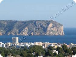
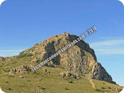
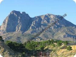
Serra del Montgó. Height 753m
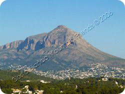 Resembling an elephants head El Montgó is an excellent landmark when sailing from Ibiza to Dénia. From the main summit excellent views can be seen of the Gulf of Valencia and Ibiza on a clear day.
It’s large size offers a variety of hikes and scrambles ranging from moderate to challenging. Steeped in history one can view the ancient water cave ,Cova de l’Aigua, with the Roman Legion inscription AD 238 and the old Roman road Cami de la Colonia also along the north face. Then there is the La Cova Ampla del Montgó (Montgó eye) and it’s caves. More than 600 forms of plant life exist in El Parque Natural de Montgó.
Route 1. La Cova Ampla del Montgó (Montgó eye). Parking at the Campo de Tiro we pick up the small track to the left of the main summit track which is normally marked with a cairn. The ascent is steep and will take about 25 minutes. Moderate hike and easy scramble into the caves.
Route 2. The Plana to Summit is the most popular tourist route and accessed from the Xábia to Dénia CV736 road. An easy traversing track leads to the main summit and the Creu de Xábia. Return via the same track. Car parking is best at either of the shooting ranges. (Campo de Tiro) to avoid a car break–in. Moderate hike and easy scramble.
Distance 9km. Duration 4hrs. Ascent 528m
Route 3. Jesús Pobre to Summit. Parking off the CV753 Xábia to La Xara road the track starts as a paved road and then changes to a rough but well defined track. Continue the ascent to the main summit path viewing the Creu de Dénia on the left. From the Creu de Xábia main summit we descend the tourist Plana track and then veer west to join the Cami de la Colonia. A small track off this Cami leads to the Cova de l’Aigua and continues to a barranco that leads back to the summit. Then head west and rejoin the track back to the car park. Strenuous hike.
Distance 16km. Duration 7hrs. Ascent 1100m
Route 4. La Plana to the Coll de Pous. Parking at the inner Campo de Tiro we ascend to the main summit. Then descend west towards Jesús Pobre and the Coll de Pous where our exit track is just a few hundred metres from the Marriott Hotel. A car shuttle is required. Strenuous hike.
Distance 12km Duration 6hrs Ascent 678m
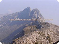
El Puig Campana. Height 1408m
 Route 1. Summit via Barranco. The well marked main tourist route is from the font straight up the large barranco. Once in the barranco we keep to the right to avoid much of the scree. At the col the summit is reached by veering right. Return to Font Moli via the same route. Strenuous hike. Grade 1 scramble. Distance 9km. Duration 5hrs. Ascent 1025m.
Route 2. Same ascent as route 1. For the descent we return to the col and then head north down a path that leads to a scree run. At the bottom of the scree a track leads to the circular path Senda Lola. From there we have a choice of returning to Font Moli via the west or east. Strenuous hike. Grade 1 scramble.
Distance 13km. Duration 6hrs. Ascent 1025m.
All heights, distances, times, grades and equipment and other information listed on this page are provided in good faith as experienced by the author but may include errors. Anyone attempting these routes should verify the information before commencing the activity in case of errors, route modifications or geological changes.
1. A hike is a long walk. 2. Ascent figures are accumulative starting from the car park. 3. Duration of the event includes short stops, a short lunch break and brisk pace. 4. Distance and ascent figures have been derived by GPS. 5. Position coordinates are in decimal degrees. 6. Spanish names are entered in the Castellano or Valenciano form.